A charleston self guided walking tour of the historic peninsula runs about 2.8 miles past ten landmarks. It takes roughly an hour without stopping, so budget about two hours for photos, reading and a break.
If this walk is one piece of a longer trip, how to plan a weekend in a new city shows how to fit it around other plans.
Why the route fits into about two hours
Charleston was founded in 1670, so its roads were not designed for modern traffic. That origin works in a walker’s favour. The terrain is flat and many of the best-known sights sit close together, so a loop of the peninsula needs no stamina and little backtracking.
The time you actually need depends on how many stops you linger at. Walking pace alone accounts for about an hour. Everything beyond that is reading plaques, photographing facades, queuing for a table or sitting by the water. Two hours suits most first-time visitors because it leaves room for all of that without turning the walk into a march.
| Route detail | Value | Planning use |
|---|---|---|
| Length | 2.8 miles | Short enough to do in one outing, in ordinary walking shoes. |
| Number of stops | Ten landmarks | Pick the ones that matter to you if time is tight. |
| Walking time without stopping | About one hour (a blogger’s estimate) | Treat it as the minimum, not the plan. |
| Commercial audio tour duration | 1 to 3 hours | Shows how widely pace and stopping time vary; two hours sits in the middle. |
| Terrain | Flat | Helps with pacing and with mixed-ability groups. |
The distance, stop count and walking estimate come from the Discovery Detour route write-up, and the duration range comes from a commercial audio tour listing.
One limit applies to this walk: it stays on the peninsula, so it does not reach Fort Sumter or anything across the water. Once the order of the walk is clear, the stops are easy to place.
The route stop by stop
The suggested order is simple. Start in the City Market area, then continue to East Bay Street and Rainbow Row, and finish at Waterfront Park. St. Michael’s Church and the Battery slot in as landmarks and extensions around that backbone.
City Market and East Bay Street
Begin at the Historic City Market, which starts at Meeting Street and stretches for 4 blocks. It is the natural place to set your pace, because browsing here can swallow time. Walk the market once at an unhurried speed, then turn toward East Bay Street. If you plan to eat before the walk, the market area is also where the Charleston Crab House sits (see the food section below).
Rainbow Row
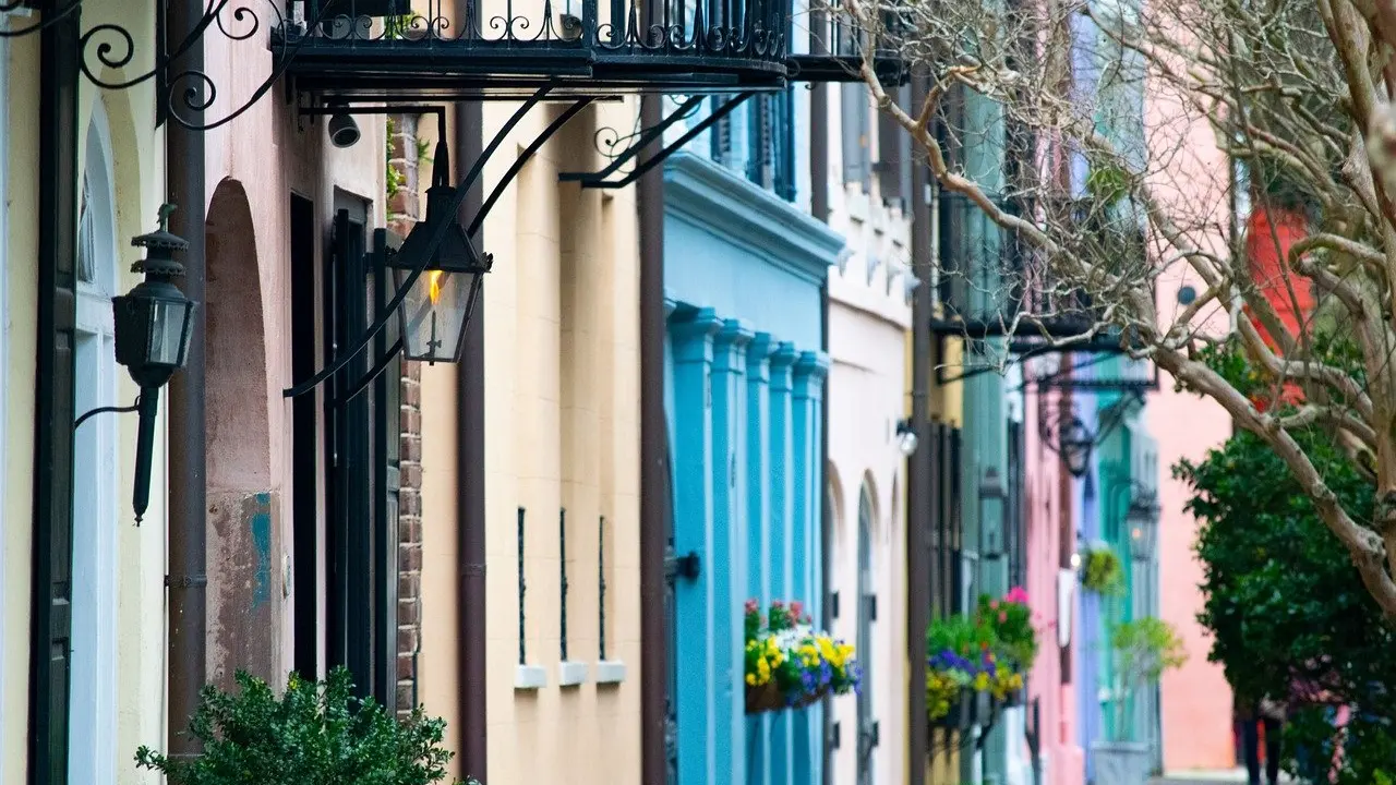
Rainbow Row is a row of 13 homes built in the 1700s. The pastel look is a later addition: the homes were repainted in pastel colors after a purchase in 1931. Stand back on the street rather than hunting for close-ups, because the whole row reads best as one continuous colour sequence. Morning light is easiest if you are photographing, and an early start also helps with crowds (see the timing section).
St. Michael’s Church
St. Michael’s was built in 1752 and is described as the oldest church in Charleston. Its steeple is the most useful navigation aid on the walk: it is hard to miss from just about any vantage point at 186 feet. If you lose your bearings between stops, look up and walk toward it.
Waterfront Park
Waterfront Park is the finish of the suggested order, and it suits the end of a two-hour walk because there is space to sit down. Its Pineapple Fountain debuted in 1990 and is the obvious spot for a last photo. Use the park as a place to recover rather than another item to tick off.

The Battery and White Point Garden
If you still have energy and time, add the Battery. White Point Garden there is a public park with picnic tables, military statues and cannons. The William Washington House is described as the only pre-revolutionary house on the Charleston Battery. Treat this stop as an extension that you drop first if the day runs short.
Best time to walk and what to check first
Go early. One Charleston blogger says their favorite way to see the city is at sunrise, when you can beat the crowds and reach downtown while most of the city is still asleep. The practical gain is clearer sightlines at Rainbow Row and an easier time stopping to read and photograph.
Before you leave, look at the Charleston National Weather Service forecast and alerts, which one walking guide recommends checking. Weather decides whether a loop with several outdoor stops is pleasant, so it is worth a minute before you commit to the full route.
Opening times and entry arrangements can change, so check each venue’s website for any place you want to go inside. A tour listing gives the same advice: check opening hours before your visit. Exteriors, streets and parks are always available to walk past, which is why this route is built around them.
Accessibility and who the walk suits
The walk suits most people. The route is flat, with many of its most iconic features close together, and the author describes it as accessible for most people. A commercial audio tour on the same ground is listed as suitable for all physical fitness levels.
Those are judgements about terrain, not an audit of every curb, doorway or paving surface. Wheelchair and stroller users should confirm access at individual venues through their websites, and should expect to spend most of the walk outdoors on public streets, which is where the route concentrates. For anyone with limited stamina, the flat terrain means you can shorten the loop by skipping the Battery and ending at Waterfront Park.
Where to eat and how to extend the walk
For a sit-down meal at the start or end, the Charleston Crab House near City Market offers southern inspired dishes with rooftop seating. For something cheaper and quicker, White Point Garden on the Battery has picnic tables, so you can carry food there.
To add depth, the Old Slave Mart museum is a serious addition to the day. One visitor reported paying for entry and spending a short time inside. Allow extra time on top of the two-hour plan and check current hours and pricing with the museum.
Planning more than one walking city? Explore Savannah On Foot: The Ultimate Self‑Guided Walking Tour (2026) follows the same self-guided approach. If museums are what you travel for, The 7 Best Art Museums In NYC To Visit In 2026 — Where To Go First covers a very different kind of city day.
Frequently asked questions
Does the walk include Fort Sumter?
No. The route stays in the stated areas on the peninsula, so it is a street-and-park walk only.
Can I go inside the Rainbow Row houses?
No, they are lived-in homes. They remain private property, so look from public spaces.
Will Rainbow Row always be pastel?
Pastel is the intended look. City ordinances are in place to help the buildings keep their pastel colors.
Is there a guided alternative to this walk?
Yes. A local operator, Charleston Sole, offers a guided two-hour walking tour if you prefer a guide to a self-guided route.